Hi,
I would like to create a graphical time zone on a map, showing noon in the world despite the local time and current location.
Something like this:
Can anyone tell me where to start?
Thank you
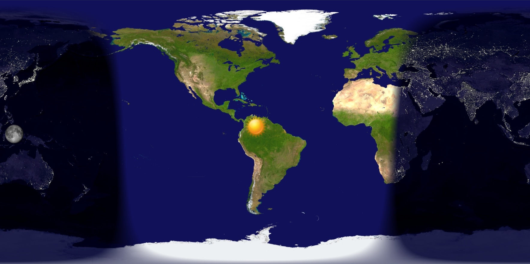
Hi,
I would like to create a graphical time zone on a map, showing noon in the world despite the local time and current location.
Something like this:
Can anyone tell me where to start?
Thank you
Hi, I would start with getting full coverage image for day and full image for night.
Then I would make them double length (add half of the loop to each side).
Then I would make them move trough the screen with the placement x coordinate like x+(([HOUR_1_24_MIN]-[TMZN_OFS_WITH_DST]+23)%24)*(image lenght in pixels). Then I would try to make a mask to make the top one of them transparent in the right places.
Just my first thoughts without checking how to work them on the WFS.
Thank you!
I had already tried something similar.
Unfortunately “[TMZN_OFS_WITH_DST]” display a string and not a numeric data.
Try to use (floor([UTC_TS]/1000/3600)%24)
check this site, there are nice examples and links too. it is not directly transferable, but may inspire you.
Thank you so much ! ![]()